Map/GIS Library
Website Plan
John Abresch
LIS 5313-321
February 15, 2004
Introduction
The USF Map/GIS Library is the regional depository for digital
geospatial data for West Central Florida and is located in the
The Map/GIS Library collection consists of both print and digital sources on the theory and application of GIS to the environment of West Central Florida. The Library has a core of significant monographs about GIS, and also many primary studies and data, which contain many socio-economic and cultural layers of digital information about the region. The digital material is supported by a strong collection of serials and other current periodical literature in the field of GIS and related fields like Geography, Urban Planning, and Environmental Science. The collection has other related GIS material in multi-media format, such as DVD, CD-ROM, and audiovisual material. As a part of the USF Library System, the Map/GIS Library has full access to the electronic journals and bibliographic databases that the Library System is subscribed to. To help support information access, the Map/GIS Library Website is intended as a seamless interface between the Library user and the different digital geospatial collections and services that the Library has to offer. The structure of the Website is built around the Library’s collections and services.
Map/GIS Library Resources
The Map/GIS Library is the depository for a variety of geospatial data
that is in both print and digital formats. The print materials are comprised of
items in the reference collection or in the map section. The areal coverage of
the print collection provides insight about spatial data for the Southeastern
United States,
The reference collection has a large number of primary works in the fields of Geography, Cartography, Urban Planning, Environmental Planning, Geodesy, and Geographic Information Systems. The reference area also houses a comprehensive collection of atlases, and gazetteers, and periodicals. The print collection also contains a large number of maps from Federal Agencies such as the U.S. Geological Survey, U.S. Census Bureau, Central Intelligence Agency, and the National Imagery Mapping Agency. A user survey of the print collection conducted by librarians during 2003 found that the top five resources in the print collection were:
- USGS Topographic Sheet Series of
- USGS Bathymetric Maps of
- CIA Political World Map Series
- Department of Commerce Economic Series
The Map/GIS Library holds a site license for ESRI, Inc. software, which
includes ARCGIS, ArcView, and Arc/Info. The Systems Librarian on staff at the
Map/GIS Library is the administrator for the site license, which includes user
in different academic departments. The digital collection contains many GIS
layers of information which are of the same areal extent as the materials in
the print collection. The digital collection does contain more comprehensive
spatial data about the
§
§
§ USGS Digital Aerial Photography Series
§
City of
§
The Map/GIS Library’s services are centered on ensuring information
access to the different geospatial data collections housed in the Library. As
part of the
· Processing GIS data from the Census Bureau
· Processing GIS data from the USGS
·
Processing specific data about the
· Requesting Bibliographic Instruction/Instruction on GIS Software
Planning User Interface
During 2003, the different user surveys had indicated that a majority of
Library users had requested information that was present in both print and
digital format, with the more comprehensive version being digital. The types of
information requests were mostly about social and economic data pertaining to
the
Services Data Holdings Networked Access
Initial Library Website Organization
Outline
The
- Library Description
- Library Data Holdings
- Library Data Services
- GIS Software Processing Help
- USF Library Networked Access
- Link to External Data Holdings
The following graphics depict the same subject areas as they would appear in the initial website organization. More website content will be developed as project develops.


The Map/GIS Library will use graphic user interfaces and website structure
Designs from relevant examples drawn from Map and GIS Libraries located at other academic institutions.

Figure 1. Univ.of
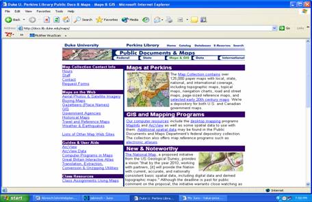
Figure 2. Duke University Map Sources. (http://docs.lib.duke.edu/maps/)

Figure 3.
The Webmaster at the Map/GIS Library and Library systems personnel at USF have tentatively chosen the University Map Library Webpages as depicted in Figures 1-3 to be preferred models in the development of the website. The design process will work to determine the preferred number of graphics, banners, and links on the web pages to adequately provide for information access.
To return please click here